Location of climatic zones on the world map. Climatic zones of Russia
Climate- the long-term weather regime characteristic of the area. The climate, unlike the weather, is characterized by stability. It is characterized not only by meteorological elements, but also by the frequency of phenomena, the deadlines for their onset, and the values of all characteristics.
It is possible to identify the main groups of climate-forming factors :
- geographical latitude of a place , since the angle of inclination of the sun's rays depends on it, which means the amount of heat;
- atmospheric circulation – prevailing winds bring certain air masses;
- ocean currents ;
- absolute altitude of the place (temperature decreases with altitude)
- distance from the ocean - on the coasts, as a rule, less sharp temperature changes (day and night, seasons of the year); more precipitation;
- relief(mountain ranges can trap air masses: if a moist air mass meets mountains on its way, it rises, cools, moisture condenses and precipitation falls);
- solar radiation (the main source of energy for all processes).
The climate, like all meteorological elements, is zonal. Allocate:
- 7 major climatic zones - equatorial, two tropical, temperate, polar,
- 6 transitional - by two subequatorial, subtropical, subpolar.
The classification of climatic zones is based on types of air masses and their movement . In the main belts, one type of air mass dominates throughout the year, in transitional belts types of air masses change depending on the season and the displacement of atmospheric pressure zones.
air masses
air masses- large volumes of air in the troposphere, which have more or less the same properties (temperature, humidity, dust content, etc.). The properties of air masses are determined by the territory or water area over which they form.
Characteristics zonal air masses: equatorial– warm and humid; tropical- warm, dry; moderate- less warm, more humid than tropical, seasonal differences are characteristic; arctic and Antarctic- cold and dry.
Within the main (zonal) types of VMs, there are subtypes - continental(forming over the mainland) and oceanic(forming over the ocean). An air mass is characterized by a general direction of movement, but within this volume of air there can be different winds. The properties of air masses change. Thus, temperate marine air masses, carried by western winds to the territory of Eurasia, gradually warm up (or cool down) when moving to the east, lose moisture and turn into temperate continental air.

Climatic zones
equatorial belt characterizes the reduced Atmosphere pressure, high temperatures air, a large number of precipitation.
tropical belts characterize high atmospheric pressure, dry and warm air, low precipitation; winter colder than summer, trade winds.
temperate zones characterize moderate temperatures air, western transfers, uneven distribution of precipitation throughout the year, pronounced seasons.
Arctic (Antarctic) belt characterized by low average annual temperature and humidity, constant snow cover.
AT sub equatorial belt e in summer equatorial air masses come, summer is hot and dry. In winter, tropical air masses come, so it is warm and dry.
AT subtropical zone tropical air in summer (hot and dry) and temperate in winter (cool and humid).
AT subarctic belt in summer temperate air dominates (warmth, a lot of precipitation), in winter - arctic air, making it harsh and dry.

climatic regions
Climatic zones change from the equator to the poles, because the angle of incidence of the sun's rays changes. This, in turn, determines the law of zoning, i.e., the change in the components of nature from the equator to the poles. Within the climatic zones there are climatic regions - a part of the climatic zone with a certain type of climate. Climatic regions arise as a result of the influence of various climate-forming factors (peculiarities of atmospheric circulation, the influence of ocean currents, etc.). For example, in temperate climate zone The northern hemisphere is divided into areas of continental, temperate continental, maritime and monsoon climates.
Nautical The climate has high humidity, a large amount of annual precipitation, and small temperature amplitudes. Continental- little precipitation, significant temperature range, pronounced seasons. monsoonal characterizes the influence of monsoons, wet summers, dry winters.
The role of climate.
The climate renders big influence to many important industries economic activity and human life. It is especially important to take into account climatic features territories when organizing agricultural production . Agricultural crops can produce high sustainable yields only if they are placed in accordance with the climatic conditions of the territory.
All types modern transport to a very large extent depend on climatic conditions. Storms, hurricanes and fogs, drifting ice make navigation difficult. Thunderstorms and fogs make it difficult, and sometimes even become an insurmountable obstacle for aviation. Therefore, the safety of the movement of sea and air ships is largely ensured by weather forecasts. For the uninterrupted movement of railway trains in winter, one has to deal with snow drifts. For this, along all railways countries planted forest belts. The movement of vehicles is hindered by fog and ice on the roads.
Characteristics of climatic zones (table below) is the topic of this article. We will talk about what types of climate exist on our planet, and also consider in detail each of them. To do this, we recall that climate is the weather regime established over the years, which depends on a particular territory, its geographical location.
equatorial belt
This climatic zone is characterized by low pressure, as well as year-round presence of air masses. There are no separate climatic regions within the belt. As for the temperature regime, it is hot here. During the year there is a lot of precipitation, moisture in abundance. The weather here changes very drastically during the day. The first half is sultry, and the second begins with heavy rains.
The names of climatic zones are associated with their features. The equatorial belt is located near the equator, therefore it has such a name.
The subequatorial belt is characterized by a change in air masses, which occurs seasonally. Equatorial air masses predominate in summer, while tropical air masses prevail in winter. The weather conditions in summer fully correspond to the equatorial type of climate, while the weather in winter resembles the conditions tropical zone. Winters are dry and slightly colder than summers.
tropical belt
As we already know, the names of climatic zones are associated with their location. This type of climate is characterized by tropical air masses throughout the year. The air is continental. The real weather of the tropical zone is high pressure and temperature, big difference temperatures not only throughout the year, but also during the day. Water is scarce in this climate. It is very hot and dry here, and dry winds often occur. There is almost no rain. The weather is usually dry and sunny.
However, the tropical belt is deceptive. The eastern shores of the continents, which are washed by warm currents, are also in this zone, but have a different climate. Tropical marine air, heavy rainfall, monsoons. Climatic conditions similar to the equatorial climate.
Subtropical zones are characterized by a change in air masses. Summer prevails tropical climate, in winter - moderate. Pressure surges in summer and winter are quite high. The pressure is low in winter and high in summer. Despite the strong difference in temperature and precipitation throughout the year, the thermometer is above zero all year round. Sometimes the temperature can even drop to negative values. During such periods, snow falls. In the flat areas, it melts quickly, but in the mountains it can lie for several months. As for the winds, the trade winds rule in winter and the trade winds in summer.

Temperate zone
The temperature of climatic zones largely depends on the air masses that prevail over the territory. AT temperate zone, as the name implies, temperate climate. But not always. Sometimes tropical or arctic air masses invade. Temperate climate characterized by large temperature differences. Summers are hot and winters are cold and long. Relatively low pressure, cyclonicity, instability of weather conditions in winter. Throughout the year, westerly winds blow, sometimes there are trade winds in summer, and northeast winds in winter. Massive snow cover every winter.
Arctic and Antarctic belts
In the characteristics of climatic zones in the table, you can see what temperatures prevail in these zones. The features of these belts are low temperatures all year round, strong winds and cold summers. There are very few rainfalls.

Subarctic and subantarctic belts
These belts are distinguished by the fact that a temperate climate prevails here in summer. Because of this, there is a large amplitude of temperature fluctuations. There is a lot of permafrost in these belts. In winter, northeastern and southeast winds, and in the summer - western. Belts have 2 climatic regions, about them below.
Territories of climatic zones
Each zone is characteristic of a certain territory. Natural and climatic zones have been formed on the planet for a long time, so it is safe to identify certain areas in which the climate of the zone is pronounced.
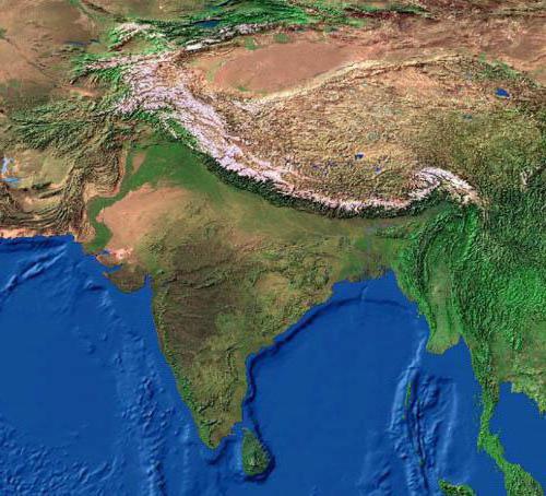
The equatorial climate is characteristic of Oceania, countries South America and Africa. Sat equatorial climate characteristic of Northern Australia and South-East Asia. central part Australia and North Africa is a tropical zone. Subtropics are characteristic of the interior regions of the continents. A temperate climate prevails in the western part and eastern outskirts of Eurasia. the belt dominates North America and northern Eurasia. The Arctic and Antarctic belts are characteristic of Australia and the waters of the Northern Arctic Ocean.

Table of climatic zones
The table shows the characteristics of the zones.
Belt | average temperature in January | Average temperature in July | Atmosphere |
Equatorial | Humid warm air masses |
||
subequatorial | Monsoons prevail |
||
Tropical | |||
Subtropical | Cyclonicity, high atmospheric pressure |
||
Moderate | West winds and monsoons |
||
Subarctic | |||
Arctic (Antarctic) | Anticyclones |
Climatic regions of the belts
Subtropical belts have three climatic regions:
- Mediterranean climate. It prevails in the northern hemisphere, on the southern and western coasts of the continents. In summer there is continental climate, and in winter - continental and maritime air masses. Summers are dry and warm, while winters are relatively cool and wet. Humidification is insufficient.
- Monsoon climate. Distributed on the eastern shores of the continents. Summer monsoons cause extreme heat and a lot of precipitation, and the winter monsoons are cool and dry. Humidity in this area is moderate. Precipitation is typical for the winter season.
- Marine climate. Distributed on the continents of the southern hemisphere. Characterized by maritime air masses. Summer and winter are warm. There is enough moisture, it is distributed evenly throughout the year.

The temperate zone consists of 5 climatic regions:
- moderate It prevails on the western coasts of the continents. The weather is formed under the influence of warm currents and westerly winds. Winters are quite mild and summers are warm. There is a lot of precipitation throughout the year. Winter is characterized by heavy and frequent snowfalls. More than enough moisture. The geography of the climate zone contributes to the instability of the weather.
- Continental temperate climate. characterized by warm summers and cold winter. Arctic air masses sometimes provoke a sharp cooling, and tropical air masses - warming. There are few precipitations, they are uniform (cyclonal and frontal).
- Continental climate. Only applies to North hemisphere. Moderate air masses prevail here throughout the year. Sometimes arctic air masses appear (in this area their invasion is also possible in summer). AT warm time There is more precipitation during the year, but in general they are insignificant. A small amount of snow and the predominance of low temperatures contribute to the existence of permafrost.
- Sharply continental climate. Typical for interior areas North America and Eurasia. The territory is practically isolated from the influence of the seas and oceans and is located in the center high pressure. Sometimes summers are hot, winters are always frosty. Lots of permafrost. The type of weather is anticyclonic. Little precipitation, little moisture.
- Monsoon climate. Distributed on the eastern side of the continents. It is characterized by seasonality of air masses. Summers are humid and warm, while winters are dry and cool. Summer precipitation is more numerous, excessive moisture.

The subarctic and subantarctic belts have two areas:
- continental climate (severe, but short winter, little precipitation, swampy territory);
- oceanic climate (fogs, a lot of precipitation, mild winters and cool summers).
The characteristic of climatic zones in the table does not include two areas of the Arctic and Antarctic zones:
- continental (little precipitation, the temperature is below zero all year round);
- oceanic climate (cyclones, little precipitation, negative temperatures).
The temperature in the oceanic climate can rise to +5 during the polar day.
Summing up, let's say that the characteristics of climatic zones (in the table) are necessary for every educated person.
Climatic zones are continuous or discontinuous regions that are parallel to the latitudes of the planet. They differ from each other in circulation. air currents and the amount of solar energy. The terrain, proximity to or are also important climate-forming factors.
According to the classification of the Soviet climatologist B.P. Alisov, there are seven main types of Earth's climate: equatorial, two tropical, two temperate and two polar (one each in the hemispheres). In addition, Alisov singled out six intermediate belts, three in each hemisphere: two subequatorial, two subtropical, as well as subarctic and subantarctic.
Arctic and Antarctic climate zone
Arctic and Antarctic climate zone on the world map
The polar region adjacent to North Pole called the Arctic. It includes the territory of the Arctic Ocean, margins and Eurasia. The belt is represented by icy and, which are characterized by long severe winters. The maximum summer temperature is +5°C. arctic ice affect the climate of the Earth as a whole, preventing it from overheating.
The Antarctic belt is located in the very south of the planet. Nearby islands are also under his influence. The cold pole is located on the mainland, so winter temperatures average -60°C. Summer figures do not rise above -20°C. The territory is in the zone Arctic deserts. The mainland is almost completely covered with ice. Land areas are found only in the coastal zone.
Subarctic and Subantarctic climate zone

Subarctic and Subantarctic climate zone on the world map
The subarctic zone includes northern Canada, southern Greenland, Alaska, northern Scandinavia, northern regions of Siberia and Far East. Average winter temperature is -30°C. With coming short summer the mark rises to +20°C. In the north of this climatic zone dominates, which is characterized by high humidity, swampiness and frequent winds. The south is located in the forest-tundra zone. The soil has time to warm up during the summer, so bushes and woodlands grow here.
Within the subantarctic belt are the islands of the Southern Ocean near Antarctica. The zone is subject to the seasonal influence of air masses. In winter, arctic air dominates here, and in summer masses come from the temperate zone. The average temperature in winter is -15°C. Storms, fogs and snowfalls often occur on the islands. In the cold season, the entire water area is occupied by ice, but with the onset of summer, they melt. Indicators warm months the average is -2°C. The climate can hardly be called favorable. Vegetable world represented by algae, lichens, mosses and herbs.
temperate climate zone

Temperate climate zone on the world map
In the temperate zone lies a quarter of the entire surface of the planet: North America, and. Its main feature is a clear expression of the seasons of the year. The prevailing air masses give high humidity and low pressure. The average winter temperature is 0°C. In summer, the mark rises above fifteen degrees. Cyclones prevailing in the northern part of the zone provoke snow and rain. Most of precipitation falls in the form of summer rain.
Territories deep into the continents are prone to droughts. represented by an alternation of forests and arid regions. It grows in the north, the flora of which is adapted to low temperatures and high humidity. Gradually it is replaced by a zone of mixed deciduous forests. The strip of steppes in the south encircles all the continents. The zone of semi-deserts and deserts covers the western part of North America and Asia.
Temperate climates are subdivided into the following subtypes:
- nautical;
- temperate continental;
- sharply continental;
- monsoon.
Subtropical climate zone

Subtropical climate zone on the world map
Part of the subtropical zone is Black Sea coast, southwest and , south North and . In winter, the territories are influenced by air moving from the temperate zone. The thermometer rarely drops below zero. In summer, the climate zone is affected by subtropical cyclones, which warm the earth well. Humid air prevails in the eastern part of the continents. Here long summer and mild winters without frost. The western coasts are characterized by dry summers and warm winters.
Temperatures are much higher in the interior regions of the climate zone. The weather is almost always clear. Most of the precipitation falls during the cold period, when the air masses shift to the side. On the coasts, hard-leaved forests grow with an undergrowth of evergreen shrubs. In the northern hemisphere, they are replaced by a zone of subtropical steppes, smoothly flowing into the desert. In the southern hemisphere, the steppes turn into broad-leaved and deciduous forests. Mountain areas are represented by forest-meadow zones.
In the subtropical climate zone, the following climate subtypes are distinguished:
- subtropical oceanic climate and Mediterranean climate;
- subtropical inland climate;
- subtropical monsoon climate;
- climate of high subtropical highlands.
Tropical climate zone

Tropical climate zone on the world map
The tropical climate zone covers separate territories in everything except Antarctica. The region dominates the oceans all year round high blood pressure. Because of this, there is little rainfall in the climate zone. Summer temperatures in both hemispheres exceed +35°C. Average winter temperatures are +10°C. The average daily temperature fluctuation is felt in the interior of the continents.
Most of the time the weather is clear and dry. The bulk of the precipitation falls on winter months. Significant temperature fluctuations cause dust storms. On the coasts, the climate is much milder: winters are warm, and summers are mild and humid. Strong winds practically absent, precipitation falls in the calendar summer. The dominant natural areas are rainforests, deserts and semi-deserts.
The tropical climate zone includes the following climate subtypes:
- trade wind climate;
- tropical dry climate;
- tropical monsoon climate;
- monsoon climate on tropical plateaus.
Subequatorial climate zone

Subequatorial climatic zone on the world map
The subequatorial climatic zone affects both hemispheres of the Earth. In summer, the zone is influenced by equatorial wet winds. In winter, the trade winds dominate. Average annual temperature is +28°C. Daily temperature fluctuations are insignificant. Most of the precipitation falls during the warm season under the influence of the summer monsoons. The closer to the equator, the more abundant it rains. In summer, most rivers overflow their banks, and in winter they dry up completely.
The flora is represented by monsoon mixed forests, and woodlands. The foliage on the trees turns yellow and falls during the drought period. With the arrival of rains, it is restored. In the open spaces of the savannas, cereals and herbs grow. The plant world adapted to periods of rain and drought. Some remote forest areas have not yet been studied by man.
Equatorial climate zone

Equatorial climate zone on the world map
The belt is located on both sides of the equator. The constant flow of solar radiation forms hot climate. On the weather air masses coming from the equator. The difference between winter and summer temperatures is only 3°C. Unlike other climatic zones, the equatorial climate remains virtually unchanged throughout the year. Temperatures do not fall below +27°C. Due to heavy rainfall, high humidity, fogs and clouds. Strong winds are practically absent, which favorably affects the flora.
Characteristics of climatic zones (table)
There are 7 types of climate zones on the planet. They are divided into two types: permanent (basic) and transitional.
Permanent climatic zones- belts where a single air mass dominates during the year.
transitional- are written with the prefix "sub", they are replaced during the year by two air masses: in summer more hot (the one closer to the equator), in winter - colder (the one closer to the pole). In December-February, airthe masses are shifted to the south, and in June-August - to the north of the planet.
Name of climatic zones: 1) Equatorial climate zone-type: permanent-main - location: located on both sides of the equator from 5°-8° northern latitude to 4°-11° south latitude, between subequatorial belts.-description: The predominance of equatorial air masses throughout the year. Constantly high temperatures (on the plains 24° - 28°C). Weak unstable winds. Characterized by the presence of a bandlow pressure with a constant influx of trade winds into it and a tendency to general upward movements of air andrapid transformation of tropical air into humid equatorial air. Abundant rainfall throughout the year.Constantly hot and humid equatorial climate, due to the large influx of solar radiation.
2) Tropical climate zone-type: permanent-primary -location: The belt is located in tropical latitudes. One can clearly distinguish the northern and southern tropical belts of the Earth. - description: in the tropics all year round dominated by one single - tropical air mass. She, in her turn, forms a zone of constantly increased pressure over the climatic zone with clear weather throughoutof the year. Thus, the weather in the tropics depends entirely on the height of the sun above the horizon. During the summer months whenthe sun rises to its zenith, the temperature in the tropics rises above + 30 ° C. In winter, when the sun is abovethe horizon is no longer so high, the temperature in the tropics drops, and on cold winter nights it can even drop tonegative temperatures. Sharp changes from heat to cold during the day and all year, as well as a low amountrainfall led to the formation of a natural zone of deserts and semi-deserts in the tropical climate zone withvery poor flora and fauna.
3) Temperate climate zone-type: permanent-primary- location: It is located between 40 and 60 latitudes, borders on the subtropical and subarctic (in the southern hemisphere - subantarctic) climatic zones.-description: There are northern and southern temperate zones on the planet, however, in southern hemisphere he almost never affects the continents. since the temperature of a moderate air mass varies with the seasons of the year, in a moderateclimate zone there is a clear change. All seasons are clearly expressed: snowy winter is replaced by spring, it is replacedhot summer comes, and autumn comes again. Temperature differences in the temperate zone are very significant. Actuallythe border with the subtropics practically coincides with the winter isotherm of 0°С. In the temperate zone, there are negativetemperature. On the large area belts in winter time snow cover is established.
4) Arctic (Antarctic) climate zone-type: permanent-primary -location: The belt occupies the polar regions of the Earth. The belt occupies the largest area in Antarctica, spreading almost the entire continent. In the Northern Hemisphere, it is located in the very north of Eurasia and North America, including inyourself to Baffin Land, Greenland, the Taimyr Peninsula, New Earth, Svalbard, Islands Of The Arctic Ocean.-description: All year long, only one arctic (in the southern hemisphere - antarctic) air dominates here. weight. Almost the entire year in the Arcticclimate zone, the air temperature does not rise above0°C, and with further removal to the poles, it always remains negative. Especially harsh winters seen inAntarctica. There is very little precipitation. The belt is occupied by the natural zone of the Arctic and Antarctic deserts. Bigpart of it is covered by a multi-kilometer shell of sheet glaciers. So much low temperatures these areasare explained by the fact that the sun never rises high above the horizon in subpolar latitudes, its rays "glide"on the surface of the earth and do not warm it up even in the conditions of a polar day, when the polar night comes (and onat the poles, they last for half a year) the surface of the planet does not receive heat from the sun at all and cools down to -70 -80 ° C.
Our planet is extremely unique. Only on Earth are the temperature and weather conditions suitable for Human life. The climate map of the world is divided into 4 main and 3 additional climatic zones, each of which is unique due to its temperature regime, precipitation rate and wind direction. It is thanks to this diversity of climate that a huge number of plants can grow on our planet: both tiny daisies and giant sequoias and eucalyptus. Let's see what these climatic zones are remarkable for.
Main belts
Within these climatic zones, the same air masses prevail throughout the year. The equatorial belt extends along the equator. Further, from the north and from the south, other belts adjoin it. closes climate map world arctic and antarctic belts. Now a little more about each of them.
Equatorial climate zone
The smallest of all. It reigns in the southern part of the Indochina peninsula, some islands of Indonesia, in the center of Africa and in a small part of South America. It rains most of the time here. They are so frequent and plentiful that moisture does not have time to evaporate. Therefore, these areas are often swampy. The temperature stays at around 24-28 degrees all year round.
Impenetrable multi-tiered jungles are an integral part of this climate. A huge number of animal species are found in them, many of which live only here, and some have not even been studied. It is in this belt that the tallest and most powerful trees in the world grow - 100-meter eucalyptus trees.
tropical belt
This type of climate is varied. So, on land, high atmospheric pressure prevails, and precipitation is extremely rare. The average temperature in summer rises to 40 degrees, and in winter it drops to +10. During the day, the fluctuation can be 35-40 degrees. These temperature fluctuations destroy rocks turning them into sand. That is why on the territory of the continental tropical belt lies the majority sandy deserts. Sahara - bright to that example. It occupies almost half of the African continent. At sea, the tropical climate is very similar to the equatorial one. Only clear skies and small seasonal temperature fluctuations distinguish it.
Temperate zone
This type of climate can also be divided into maritime and continental. Marine is different cool summer and mild winters westerly winds that blow all year round. This belt extends along west coast America and Eurasia. The temperate continental climate is not so mild, since cyclones rarely pass deep into the mainland. Therefore, it has hot summers and cold winters. For example, in some regions of Siberia, in summer the air warms up to +30, and in winter it cools down to -40 degrees.
polar belt
It dominates the arctic and antarctic regions the globe, forming the belts of the same name all year round here frost. This is where things like Northern Lights, polar day, polar night and permafrost. Clear skies, light winds, ice fields and bitter cold are what make this uninhabitable climate remarkable. Only penguins can live here.